
Scar Ridge
Named for the prominent slides which streak its northern and southern flanks or the appearance of my arms following a bushwhack to its 3,774’ blowdown riddled summit?
The ridge stretches northwesterly from its high point of the main Mount Osceola (4,320’) to its Middle Peak (4,200’), West Peak (4,114’), Northwest Peak (3,720’), before dropping to its low point of which the East Pond Trail passes and rises back up to form the backbone of the Scar Ridge: Southeast Peak (3,600’), East Peak (3,620’), Peak 3,400 (3,400’), Middle Peak (3,480’), and finally Scar Ridge (3,774’) before dropping to become book-ended by Loon Mountain (3,065’) and several other minor peaks.

Big Coolidge, Whaleback & Potash Knob while ascending Loon Mountain
Climbers tend to get creative with this ascent, as it is a true bushwhack; some trek northwest from Little East Pond and others from the north. I decided to begin my trek at a place I had driven past hundreds of times while coming and going from the White Mountains - Loon Mountain Ski Resort.
As it was October and foliage was past its prime, having yet to drop - certainly snow was no where in sight; which to me meant a large, mostly available parking lot. Perhaps busy with mountain bikers on weekends, I parked beside 5 other vehicles at 8:30am on a Wednesday.

Southern Franconia Ridge from the Northeast Peak of Loon Mountain
Trying to be respectful of paths, I ascended first the Brookway Trail which was more of a dirt and gravel maintenance road running along Boyle Brook; all was quiet and it seemed as if I had the mountain to myself. Quickly, the sight and sound of the Kancamagus Highway fell from my awareness, finding myself in lush tree cover along the eastern slope of Loon Mtn.
From the Summit Lodge atop the West Peak I dropped off the backside heading southeast with the big dome of North/Northeast Peak looming just ahead, what a blast trail running ski trails can be in the off season.

Dipping into the trailless forest of Scar Ridge
From just east of the North Peak Express Quad unloading area I found an opening in the wall of dense forest, a warning sign even hung in the nearby trees alerting hikers and skiers they were departing the resort and rescue would be difficult if it could happen at all in the trailless forest which lay just beyond the border.
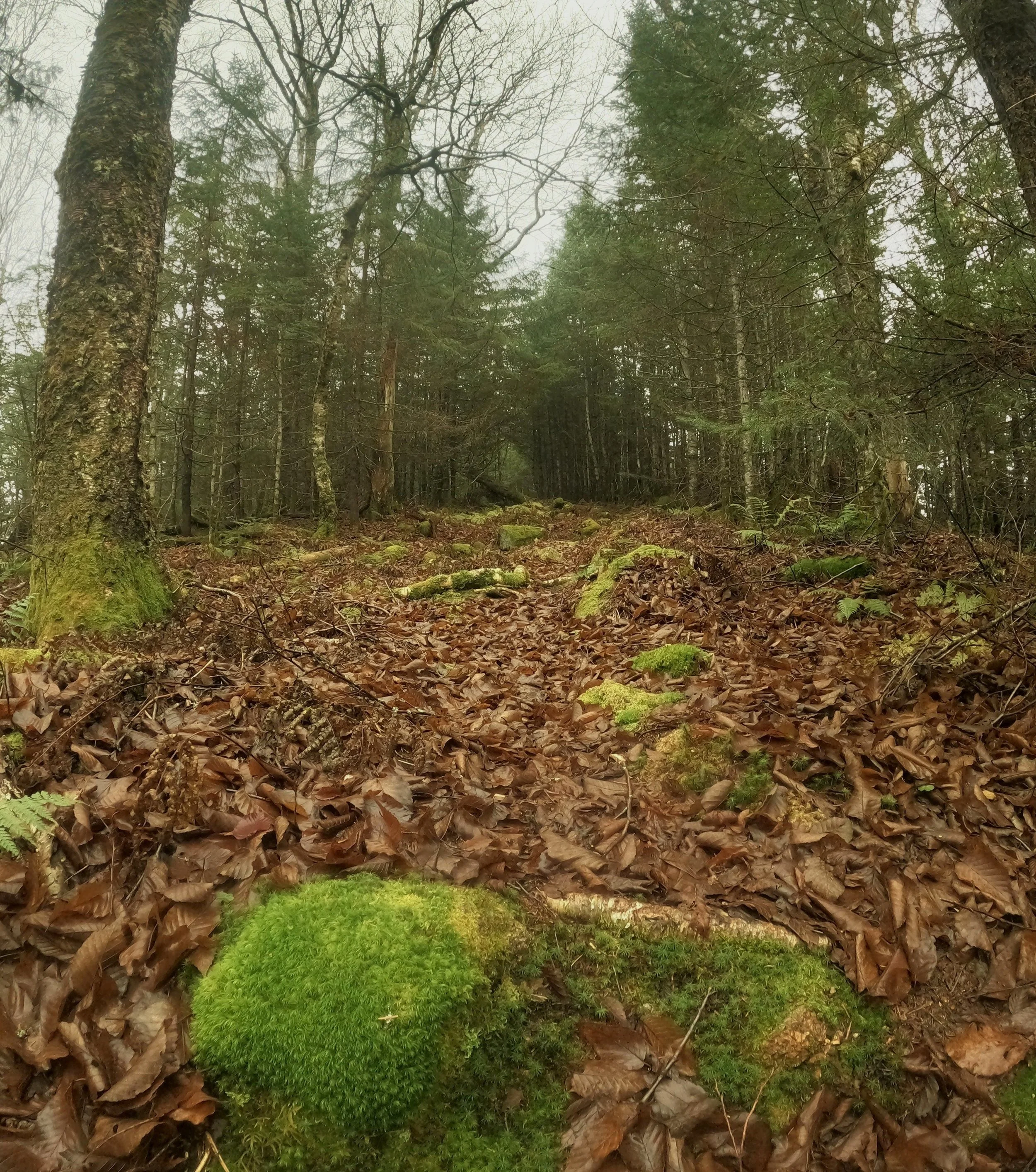
It was like walking into a fairytale forest; a soft moss-carpet lay to either side while the footpath was gently worn, consisting of dry conifer needles and dark, damp soil. Adding to the multitude of greens were ferns at foot level while at eye level, balsam and birch were cloaked in lichen and moss, showing the old age of the forest atop the ridgeline.

Beautiful herd path before the treacherous blowdown ahead
My very obvious path continued to prove a rather efficient 0.7-miles before swinging northeast, as if to track toward Black Mountain (2,937’). I quickly noticed the sensation (and partly the ability to very roughly see ridgeline outlines through the canopy) of descending off the wrong ridge and in the incorrect direction and backtracked, finding the well-hidden, less trodden footway to continue southeasterly, ascending the ridge.
With a fair amount of leaf duff and blowdown coverage to contend with, the forest floor also grew wet, forcing me to meander around several boggy areas of standing water.
Soft paths of the early Scar Ridge
Once the real climbing began along the northwestern shoulder of the Scar, I could occasionally follow tack marks made by hikers’ spikes in colder weather, finding and then losing a faint herd path all the while.
For most of the bushwhack I was able to skirt around patches of heavy blowdown but nearing the actual summit, I think, was unavoidable. As if a burst of torrential winds came and simultaneously knocked most trees down into an entangled birds nest of blowdown.

Getting thick toward the top of Scar
Crawling up, over and often times under the fallen trees, I picked my way one step at a time toward higher ground, which was nearly leveling off near the summit. One perk of having so many trees removed from the enveloping conifer canopy, however, were the glimpses of views out to the surrounding hillsides - after being engulfed in forest for so long, this was a very nice reminder of the outside world.
When I could stand on relatively flat ground and see the crooked orange canister with the wooden sign with the engraved SCAR, all concerns of that scarring bushwhack fell aside. I know well enough that reaching the summit is only half of the climb, but at least I knew the mess I’d be contending with before I reached the open ski slopes once again.

Standing on fallen debris to catch a view
On the trek back down the ridge it seemed much easier to pick up and follow the faint herd path, I seemed to avoid most of the blowdown sections that I trekked through on the way upslope. With a bit of a trail run trot I jogged through the softly beaten herd path which I began on, if only I could have more of this sweet path!
It was now mid-morning and I still had yet to see people on this usually busy mountain. With wide-open availability of the mountain bike trails I had way too much fun trail running down and around the sharp, bermed corners, even catching some air and busting out some funky moves off some of the bike jumps.

Fallen trees litter the mountain top around the canister
Scar Ridge was a good introduction to how gnarly bushwhacking can get, while the trees weren’t as tightly knit as other forests I’ve trekked, the entangled blowdown encountered while gaining its ridgeline is one that will long live in my memory. Good climbing!
Overall stats for the day:
10.62-miles
3,976’ elevation gain
3hr 31 minutes
Scar Ridge (West Peak) - 3,774’